

Dunghill, Montgomery County, Maryland - Land owned by Martin Houser
Those researching the land known as Dunghill may wonder about its location. These descriptions and maps are the ones put together to solve that mystery. Note that maps on this page are smaller versions you may not be able to read. Clicking will open full size and you can use your browser's back button to return here. (Most of the full size images are between 1 and 5 megabytes)
The oldest overall map of Maryland that we have easy access to is from 1823. Montgomery county is the blue one in the center between the pink ones (map on left), Zooming in, to the 1865 map on right, we see the townships in Montgomery county, Rockville being the one of interest (note the offset orientation of north).
Description: "Dung Hill, surveyed for Walter Evans, August 10th, 1715, containing five hundred and thirty-six acres. It was situated on the Potomac, at the mouth of Watts' Branch. The Chsapeake and Ohio Canal runs through it, as does also the river road, from near Watts' Branch to Cornell's farm. Immediately below this grant, lying along the Potomac, comes Thompson's Hop Yard..." (The History of Montgomery County Maryland by T.H.S. Boyd, pgs 33-34)
According to Answers.com, Watts Branch is a tributary stream of the Potomac River in Montgomery County, Maryland. The headwaters of the stream originate in the city of Rockville, and the branch flows southwest for about 10 miles (16 km), under the C&O Canal near Swain's Lock, to the Potomac River, which drains to the Chesapeake Bay.
On the early 1700s original land patents found in "The Potomac Adventure", #2 is Dunghill, adjoining "The Island" and "Watts Island" (#5). By 1865, some of Dunghill has been sold off, and it looks as heir "J Hauser" has the only remaining portion.


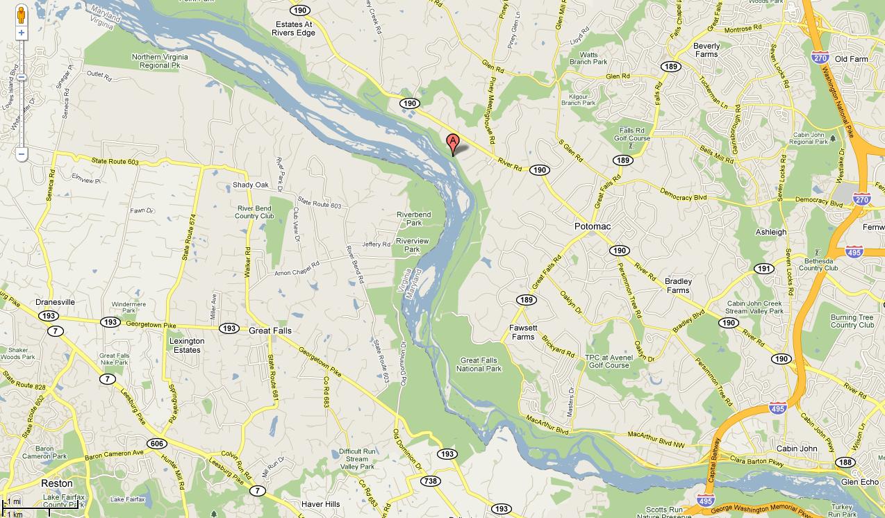
On the map showing J Hauser's remaining piece of Dunghill, there are noticable islands. The southern of the two is probably the one prominant in the map below right, though it's not possible to say for sure due to the lack of precision in 1865. The "marker" on current maps is at Swain's Lock Run. Watts Branch couldn't be located on the modern map, so used Swain's Lock as a marker instead..

A librarian at the Montgomery County Historical Society says that they have early plats that have been prepared for all the pre-1800 land patents in the county. We'll be asking her to look at this page to see if she has anything more definitive.